blah blah blah
Mt. Shannon
Length: 1.1 miles out-and-backDifficulty (click for info): Beginner
Elevation Gain: 450 feet (+10 feet on return)
Rating (click for info): 6/10
Elevation: 1266'
Prominence: 278'
Driving Directions:
From the sharp curve on Rt. 11 in downtown Alton Bay, just west of the bridge over the outlet of the bay, drive west up Rand Hill Road. In 0.7 miles, take a left onto Alton Mountain Road. In another 1.9 miles, turn left onto Avery Hill Road. Drive 1.7 miles on Avery Hill Road and turn right onto Places Mill Road. In 0.9 miles, turn right onto Griswold Road at signs for the Hidden Valley Scout Camp. 1.1 miles in, stay straight in the middle of three forks as you proceed through the hub of the camp. In the summer months, it may be best to find a place to park before passing through the center and walk the remainder of the raod to the trailhead. Stay on the road to the left of the buildings but to the right of the drive along the lake shore. 0.6 miles from the fork, along a leftward curve in the road, look for a trail sign on the right and park on the roadside on the left. Click here for a Google map.
About the Hike:
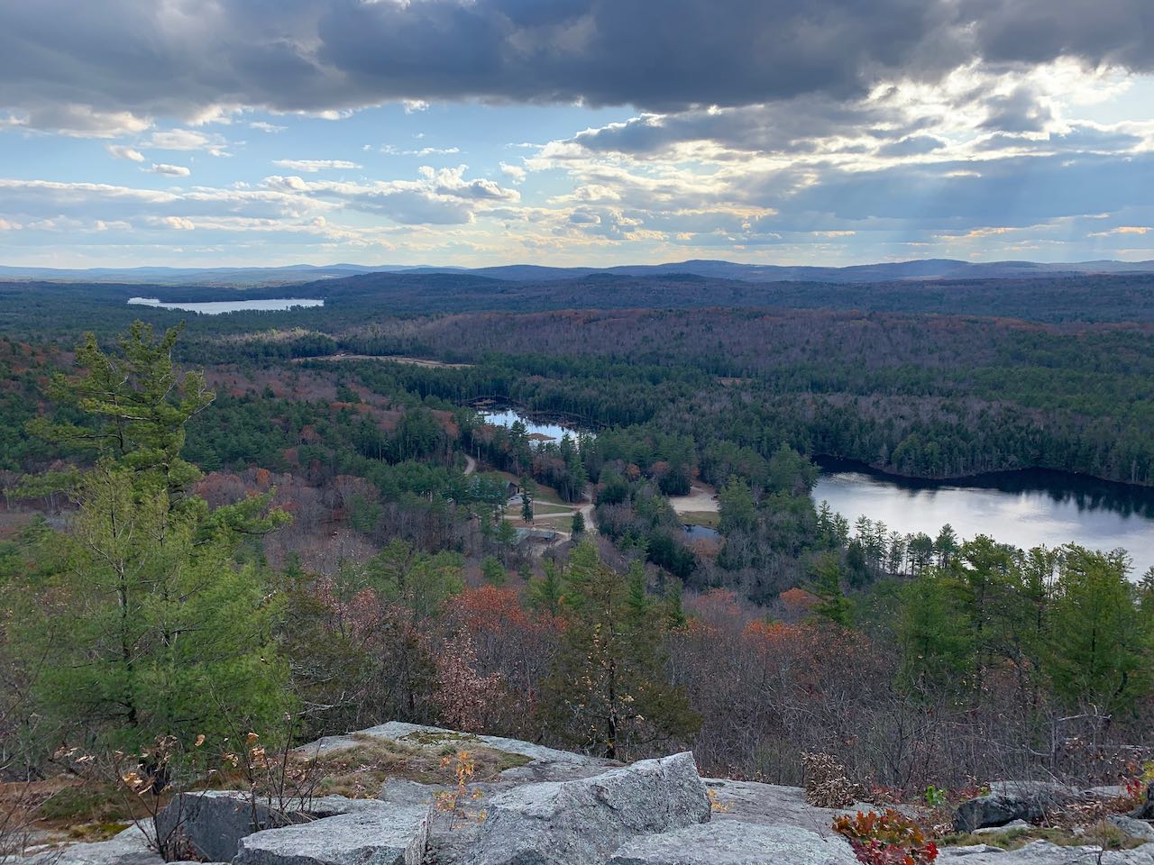
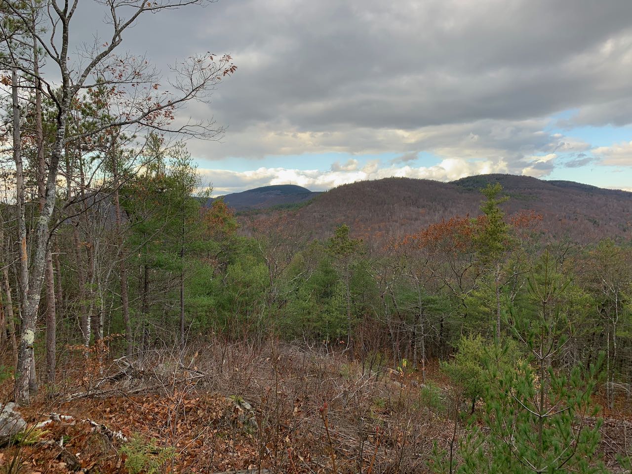
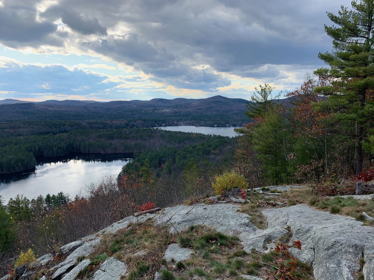
Mt. Shannon is not on the list of the major summits of the Belknap Range, but it offers one of the most exciting views in the range. Although significantly lower in altitude then the main crest of the Belknaps, Shannon's summit is patched with open ledges that provide wide vistas that are especially scenic because of its location in the midst of a cluster of four pristine lakes. It's one of the easiest summits in the range to get to, being a quick half-mile jaunt from down by Lake Eileen.
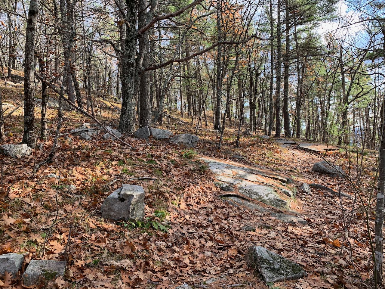
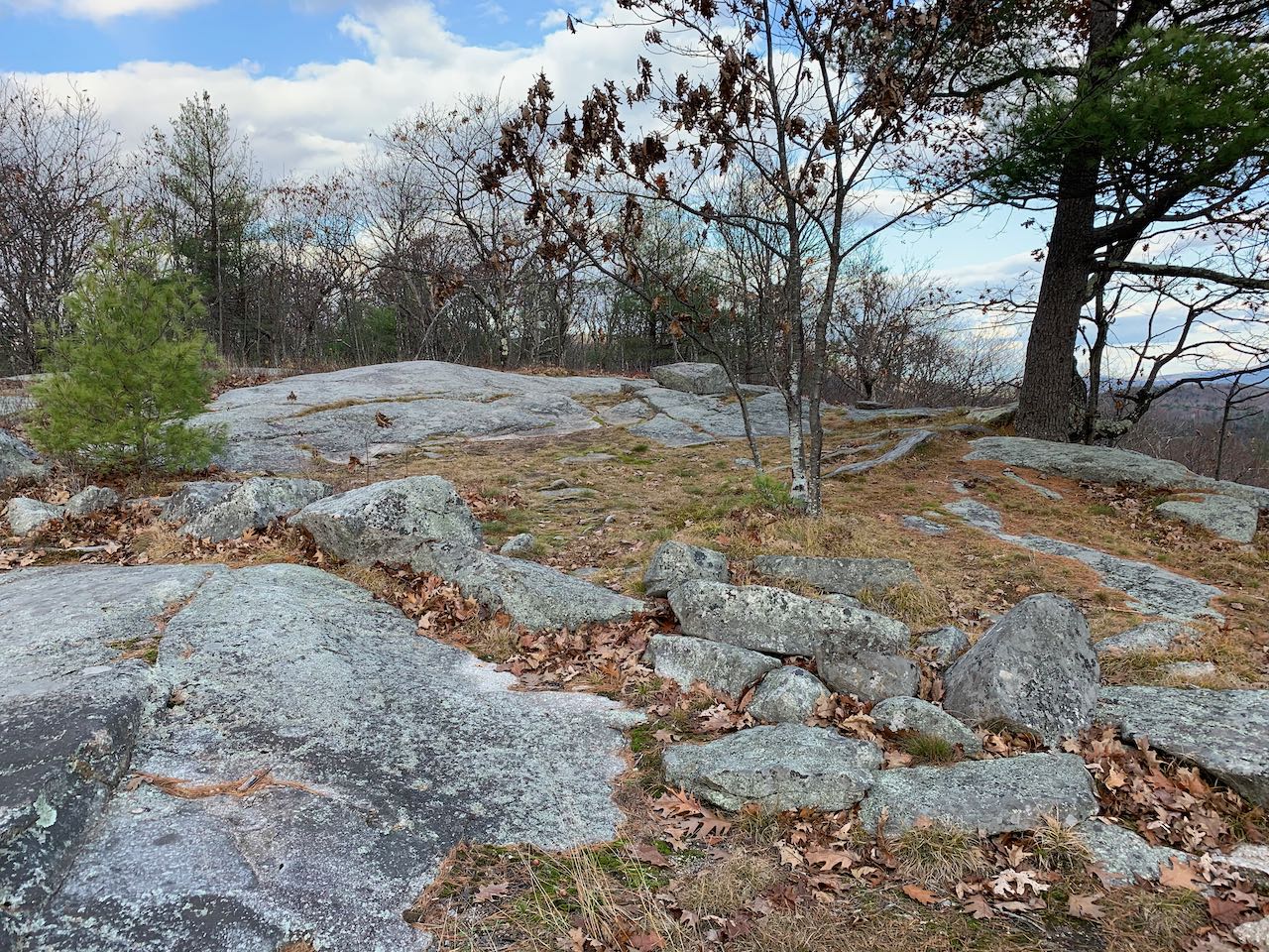
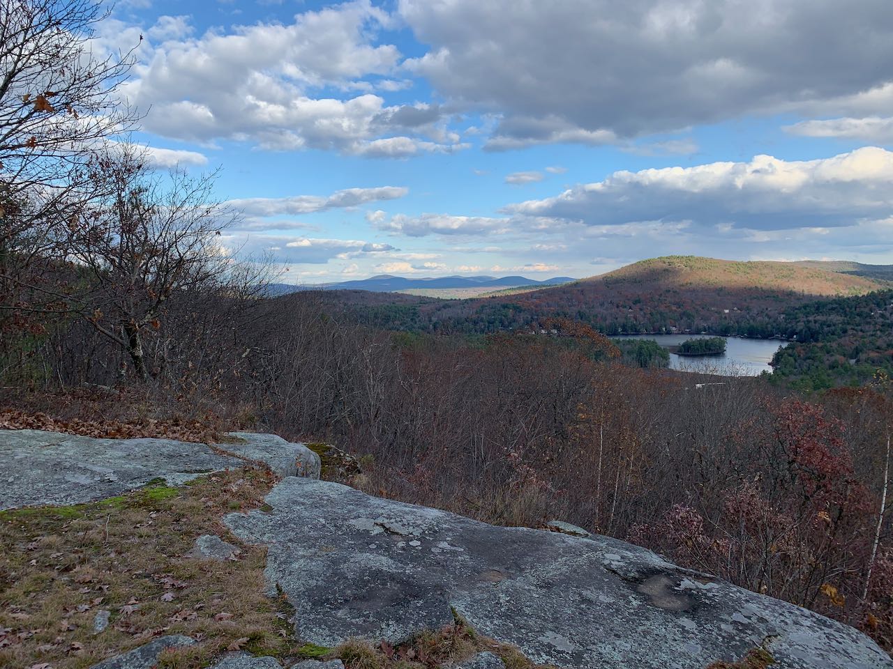
Head into the woods on the right side of the road on the Yellow Trail. Just 250 feet in, fork right as Orange Trail splits off to the left. The trail leads uphill at a brisk pace through a stony gully, surrounded by birch trees. After about 0.1 miles, the trail swings to the right up the rounded top of the hill. The path weaves gently upward through sparse trees growing around shallow ledge patches for a quarter mile to reach the wide, open summit of Mt. Shannon. From the spacious, rocky hilltop, you can enjoy the delightful vista over the lakes and the rolling hills that stretch out behind them. Up close, on the right side, you have Manning Lake and Lake Eileen. Next to Eileen, you look back down on the center of the camp. The larger waterbody out in the distance is Crystal Lake, and behind it in the distance are some of the small mountains in southeastern NH, including the Blue Hills and the Pawtuckaways. Off to the east side of the mountain, you overlook Sunset Lake and Hills Pond, with nearby Avery Hill and Rocky Mountain behind them. All the way to the left, the view extends out to a cluster of peaks around Copple Crown Mountain. If you follow the combined Yellow and Blue Trails (a left from the direction you came up) for just 350 feet, you'll find a cleared-out viewpoint on the other side of the top, facing toward the higher summits of the Belknaps. Mt. Anna is closest, and you can see the towers on Belknap Mountain off to the left.
Printable directions page